
How Kanawha Property Search Works
A good property search narrows from a broad clue to a stable parcel key. It then moves from the assessment record to the source instrument. The Assessor Property Inquiry offers owner-name, address and parcel-ID searches. Its linked IAS portal splits the work into modes. These cover basic, appraisal and sales, advanced, and prior ownership. Results come from the tax roll. So they can identify a parcel without proving current legal title.
Start with the address when the location is known. If that fails, try the street name or the owner's surname. Once a card appears, copy the full parcel ID. Also copy the map or district, legal description, situs and mailing addresses, and deed book and page. Those details let you compare the result against the GIS viewer. They also help with the County Clerk record instead of guessing from a name alone.
- Enter the address, owner name or parcel ID in IAS or the Assessor inquiry path.
- Compare multiple matches by street, district, class and legal description.
- Save the owner, mailing address, parcel ID, GIS ID and deed book/page.
- Open the WV Property Viewer and check physical location and E-911 addresses.
- Use the Clerk index to confirm the latest deed when ownership is the question.
These steps serve everyday purposes. Property maintenance, purchase research, tax questions, and local history all draw on them. Each portal has its own job. A GIS result is not a deed, and a tax card is not a survey, so keep the tools in their lanes as the work moves forward.
Search Kanawha by E-911 Address
The WV Property Viewer includes a Search by E-911 Address mode. Enter the street number and street, the city, and West Virginia. Its address layer tracks physical locations only. A post-office box or rural route will not work. A successful result connects an address point to a parcel. It displays a GIS ID and lists the E-911 addresses inside a chosen tax parcel.
The Kanawha Assessor Property Inquiry is the county's entry point to these property tools. It opens the door; it does not promise that every address result will be complete. An address may carry an old number. It may show a different mailing city or several buildings at once. Compare the parcel card with the map and keep the legal description close before treating two addresses as one property.
When the E-911 field returns no match, switch to parcel attributes and select Kanawha County. A full address can be too strict where street data is thin. The street-name fallback below often works better in those spots.
When a Kanawha Address Fails
IAS property addresses can be incomplete. The viewer itself recommends searching a street name when a full address will not match. Try the street without a direction or suffix. Then sort the results by owner, community, parcel ID and legal description. Never lean on a ZIP code as a stand-in for city limits. Postal labels and municipal boundaries rarely line up.
Kanawha spans downtown lots, hillside parcels, river corridors, rural tracts, and new or reshaped subdivisions. An address can vanish from one screen. The tax parcel may sit quietly under a different street label. A corner parcel may carry more than one E-911 address. Stacked floors or overlapping geometry can even produce multiple map results. The map panel shows the address list, and the card carries the legal land description.
After two failed searches, try an owner name. A map number or a known deed book and page can work too. For a Charleston permit or zoning question, search that city system separately. A county ownership result and a municipal permit result are different records about the same place. Each answers only its own question.
Search Kanawha Owners by Name
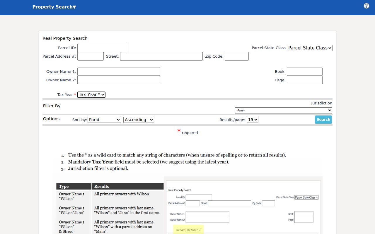
The IAS owner field accepts name searches. The WV Viewer handles owner-name search through parcel attributes. Map guidance suggests LASTNAME FIRSTNAME format, and partial names are allowed. Begin with a surname. Then add a first name, district, street or map number to tighten the list. A limited-liability company, trust or estate may appear on a card. Search the exact entity name instead.
Shared names are common. So weigh the mailing address, physical address, parcel description and deed reference together. An LLC's registered agent is a Secretary of State clue about the entity filing. It is not necessarily the person who owns the land. The SOS Business Entity Search shows an organization's type, city, status and registered-agent details. Even a clean name match there needs a deed or assessment link. That link is what ties the name to a parcel.
The IAS property search supplies these owner and parcel fields directly. Its search modes can shift as the live system changes.
Never infer a home location from a mailing address. West Virginia's Address Confidentiality Program lets eligible people use a substitute address. The two can differ by design. Search only the public record needed for a lawful property question, and no more.
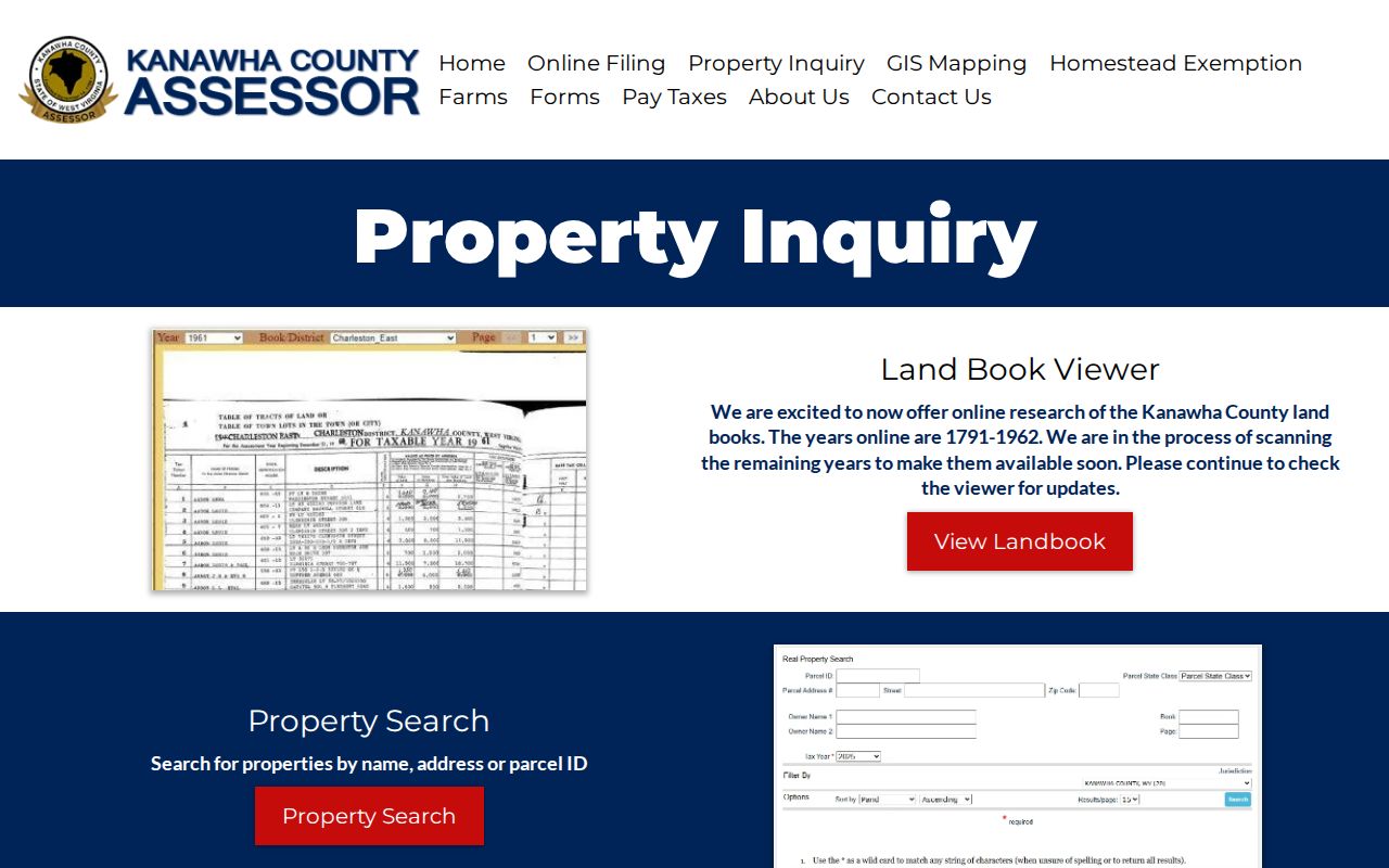
The Assessor describes its owner and address search tools on the office page. It is the same page shown below.

Keep the owner-search route distinct from the Clerk's deed index and the GIS map, since each tool answers a different question about the same parcel.
Read a Kanawha Parcel ID
The full parcel ID is the strongest key for Kanawha County property records. The statewide viewer documents an IAS-style number in four-digit segments with leading zeroes. Its example, 2001100010000, reads as 2-0011-0001-0000. That example shows the format only. It does not identify a specific Kanawha district or parcel.
Search with the whole number, hyphenated or not. Or fill the county, district, map, parcel and suffix fields in the guided search. Kanawha's public pages publish no complete local map-number allocation. Copy the ID exactly as it appears on the current card. Keep the legal description beside it. A parcel number can change after a split, combination, plat, annexation or assessment-system update. So an old number may not resolve forever.
Older records add another wrinkle. The modern parcel number may not exist in the historical book. So the owner's name, district, page, tract wording or deed reference often becomes the bridge between eras.
Fields on a Kanawha IAS Result
IAS search modes include Basic, Appraisal/Sales, Advanced and Prior Ownership. The fields let a researcher filter by identity. They also filter by location and class. Searches can narrow by value, building traits and sale details. Optional display controls can add the legal description and GIS parcel ID. Remember that a blank value does not prove no record exists. It may only mean the chosen mode or field did not expose it.
| Field group | Examples | Search use |
|---|---|---|
| Parcel identity | County, district, full ID, map, parcel, sub-parcel | Match the exact tax unit |
| Owner and address | Owner, mailing address, street name | Separate tax mail from situs |
| Land and class | Property class, tax class, land use, acreage | Compare similar assessment records |
| Value and sale | Appraisal ranges, sale date and price ranges | Locate a valuation or transfer clue |
| Record reference | Deed book, page, legal description | Move from roll to the Clerk |
| Building and hazard | Year, area, structures, flood hazard | Review listed physical traits |
The statewide IAS property search is the central assessment screen linked by the county. Keep a dated note of the fields you chose and the exact result you used. Assessment values and owner details can change as the tax roll is maintained.
What a Kanawha Search Result Shows
A selected WV Property Viewer result can return a GIS ID, owner, physical address, class type, legal description and community. It can also return map links, an IAS link, a flood-tool link and an E-911 address list. Expanded details may show building information, cost values and appraised values. The IAS card adds a mailing address, deed book and page, tax class and land use. It also adds sale filters and other assessment fields.
Treat the row as an inventory of clues. The owner of record points to the tax roll. The mailing address marks a notice destination. The physical address locates the structure. The legal description identifies the land in record language. The deed book and page serve as a cross-reference rather than the deed image itself. The GIS ID is a map key, not a title number.
- Parcel
- A tax and map unit the county tracks as one piece of land.
- Situs address
- The physical location used for the property.
- Owner of record
- The owner name carried in the assessment roll.
- Prior ownership
- A search mode that surfaces earlier assessment names, not a certified title chain.
For a transfer that just happened, open the Clerk index and compare the newest recorded instrument with the assessor card. West Virginia law requires monthly title-transfer reporting to the Assessor by the tenth day of the month. Even so, it promises no exact date for a public card refresh.
Use Kanawha GIS to Check a Match
The WV Property Viewer joins address and parcel records to a map. Turn on property parcels, address labels and flood zones as needed. Geometry search supports a Point, Rectangle or Polygon, with a buffer option for a point. That can distinguish two same-street parcels. It can also narrow a nearby parcel after an address search returns several candidates.
The result list is capped at 1,000 records. A broad shape can return too much. Reduce the geometry or use a point buffer around the subject. Hovering can highlight a result, and selecting a row zooms to its map detail. The county assessor's own GIS may be unavailable at times. The statewide viewer is the documented fallback. Map lines remain assessment reference data.
The Kanawha parcel map instructions focus on layers and boundary limits. A property search should stop at parcel identification. When a question needs a legal boundary, use the Clerk, plat or survey instead.
Kanawha Prior Ownership and History
IAS includes a Prior Ownership mode. But the public landing page does not state its coverage span or promise that every earlier owner appears. For deeper history, the assessor advertises land books from 1791 to 1962. They sit in a separate viewer with year, book/district and page fields. Those are tax-book entries, not deed images.
State Archives finding aids list Kanawha deeds from the eighteenth and nineteenth centuries. They also list grantor and grantee indexes into the twentieth century, and separate trust-deed, release, survey, will and tax series. Note the exact year and index type being requested. A grantee index locates a conveyance into an earlier owner. A grantor index follows a transfer out. The online County Clerk page publishes no starting year. So do not guess where web coverage ends.
For a modern recorded deed chain, see the Kanawha County deed records workflow. It explains how to use the Clerk index. It does so without confusing an assessment history with legal title.
Address, Owner or Parcel Search
Choose the search key that matches what you already know. An address is intuitive but may be missing or stale. A name helps with entity or owner research but can produce duplicates. A parcel ID is precise but may be unknown or recently changed. Whichever path you take, end at a card. You can cross-check it against the deed and the map.
| Starting key | Best for | Common check |
|---|---|---|
| Address | A known home, building or site | Try E-911 and street-name search |
| Owner name | Finding parcels held by a person or entity | Match district, mailing address and legal description |
| Parcel ID | Exact parcel lookup and map cross-reference | Retain all number segments and suffixes |
A search result is a pointer to county data. It is not a title search, and a map result is not a survey. Confirm a transfer with the recorded deed and a boundary with the recorded plat or a licensed survey.
Property research works best when you start with what you already know. A street address, an owner of record, or a parcel number can each unlock the deed, tax roll, and appraisal files held by Kanawha County. Every search path leads to the same records in the end.